


Pollock Voting District, Sullivan County, Missouri
About
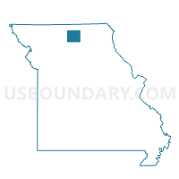
Outline

Summary
| Unique Area Identifier | 611448 |
| Name | Pollock Voting District |
| County | Sullivan County |
| State | Missouri |
| Area (square miles) | 43.06 |
| Land Area (square miles) | 42.95 |
| Water Area (square miles) | 0.11 |
| % of Land Area | 99.75 |
| % of Water Area | 0.25 |
| Latitude of the Internal Point | 40.34239290 |
| Longtitude of the Internal Point | -93.12592630 |
Maps


Graphs
Select a template below for downloading or customizing gragh for Pollock Voting District, Sullivan County, Missouri


Neighbors
Neighoring Voting District (by Name) Neighboring Voting District on the Map
- Boynton Voting District, Sullivan County, MO
- Jackson Voting District, Putnam County, MO
- Medicine Voting District, Putnam County, MO
- Newtown Voting District, Sullivan County, MO
- Pennville Voting District, Sullivan County, MO
- Wilson Voting District, Putnam County, MO
Top 10 Neighboring County Subdivision (by Population) Neighboring County Subdivision on the Map
- Wilson township, Putnam County, MO (598)
- Jackson township, Sullivan County, MO (438)
- Clay township, Sullivan County, MO (410)
- Medicine township, Putnam County, MO (189)
- Buchanan township, Sullivan County, MO (174)
- Jackson township, Putnam County, MO (160)
Top 10 Neighboring Place (by Population) Neighboring Place on the Map
Top 10 Neighboring Unified School District (by Population) Neighboring Unified School District on the Map
- Putnam County R-I School District, MO (4,843)
- Milan C-2 School District, MO (3,958)
- Green City R-I School District, MO (1,731)
- Newtown-Harris R-III School District, MO (497)
Top 10 Neighboring State Legislative District Lower Chamber (by Population) Neighboring State Legislative District Lower Chamber on the Map
Top 10 Neighboring State Legislative District Upper Chamber (by Population) Neighboring State Legislative District Upper Chamber on the Map
Top 10 Neighboring 111th Congressional District (by Population) Neighboring 111th Congressional District on the Map
Top 10 Neighboring Census Tract (by Population) Neighboring Census Tract on the Map
- Census Tract 9601, Putnam County, MO (2,725)
- Census Tract 9602, Putnam County, MO (2,254)
- Census Tract 4801, Sullivan County, MO (2,124)
- Census Tract 4802, Sullivan County, MO (1,579)
Top 10 Neighboring 5-Digit ZIP Code Tabulation Area (by Population) Neighboring 5-Digit ZIP Code Tabulation Area on the Map
- 63565, MO (3,805)
- 63556, MO (3,779)
- 63545, MO (1,111)
- 64667, MO (395)
- 64655, MO (264)
- 63560, MO (239)